See your farm like never before.
The intelligent eye in the sky — satellite imagery, weather, and soil data turned into simple, powerful insights that help you grow smarter, plan better, and harvest more.
/01See it in action
Live today at aetherview.app — onboarding farms across Nigeria.
/02What it does
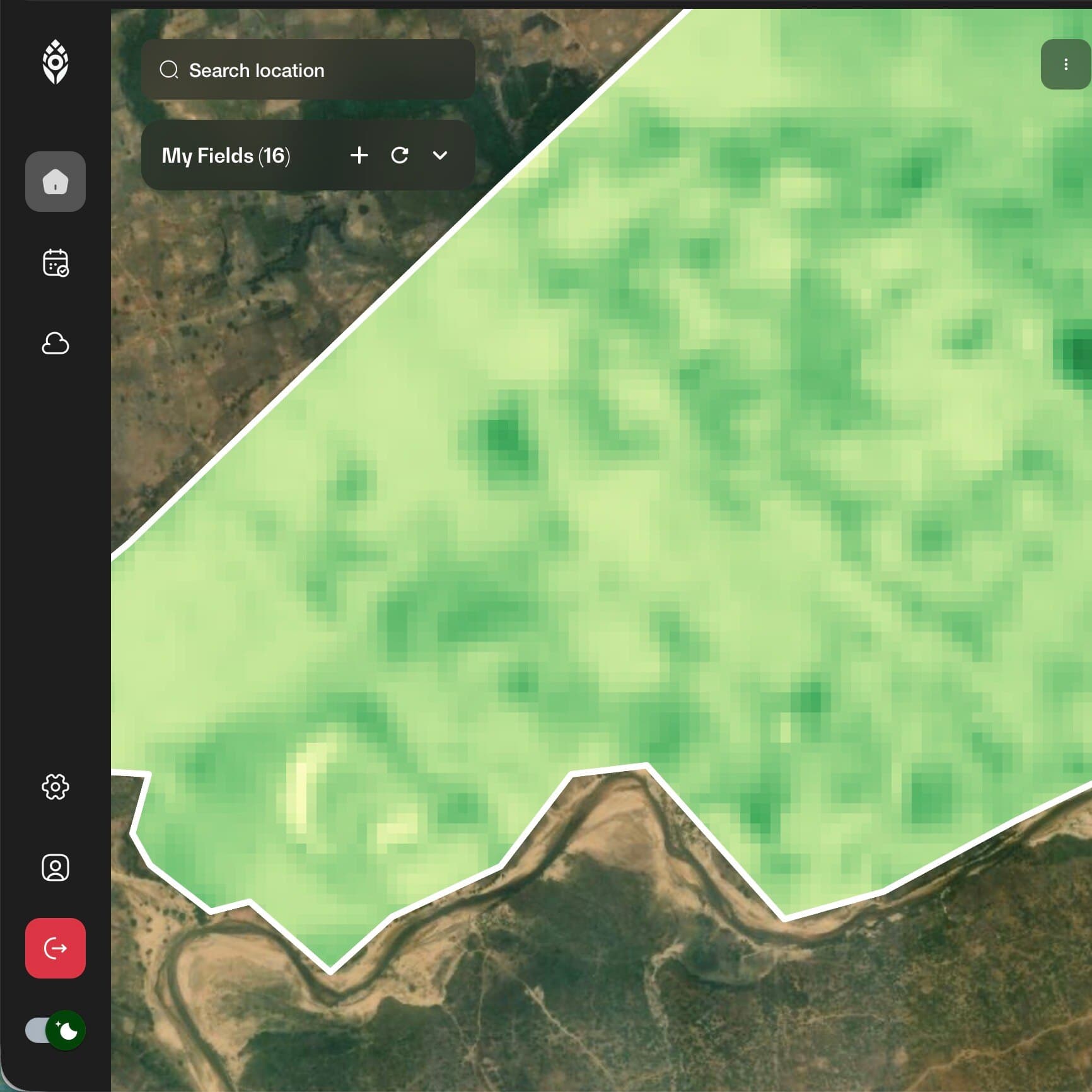
Satellite Crop Monitoring
High-resolution views of every field, updated continuously — detect crop stress and growth anomalies before they become losses.
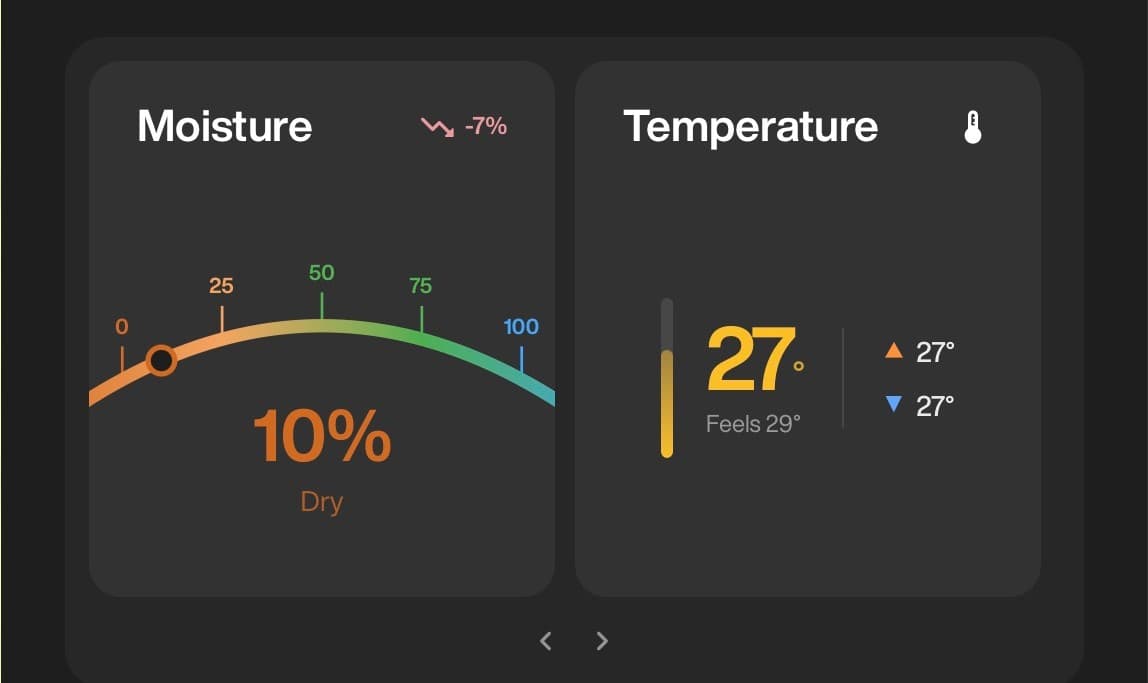
Weather & Soil Intelligence
Live weather feeds fused with soil composition analytics, so every recommendation is grounded in what your land is actually doing.
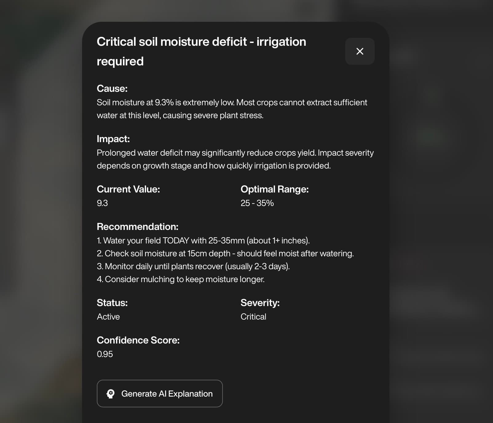
AI Crop Recommendations
Planting, irrigation, and fertilizer guidance computed for your fields — not generic advice, but decisions ranked by impact.
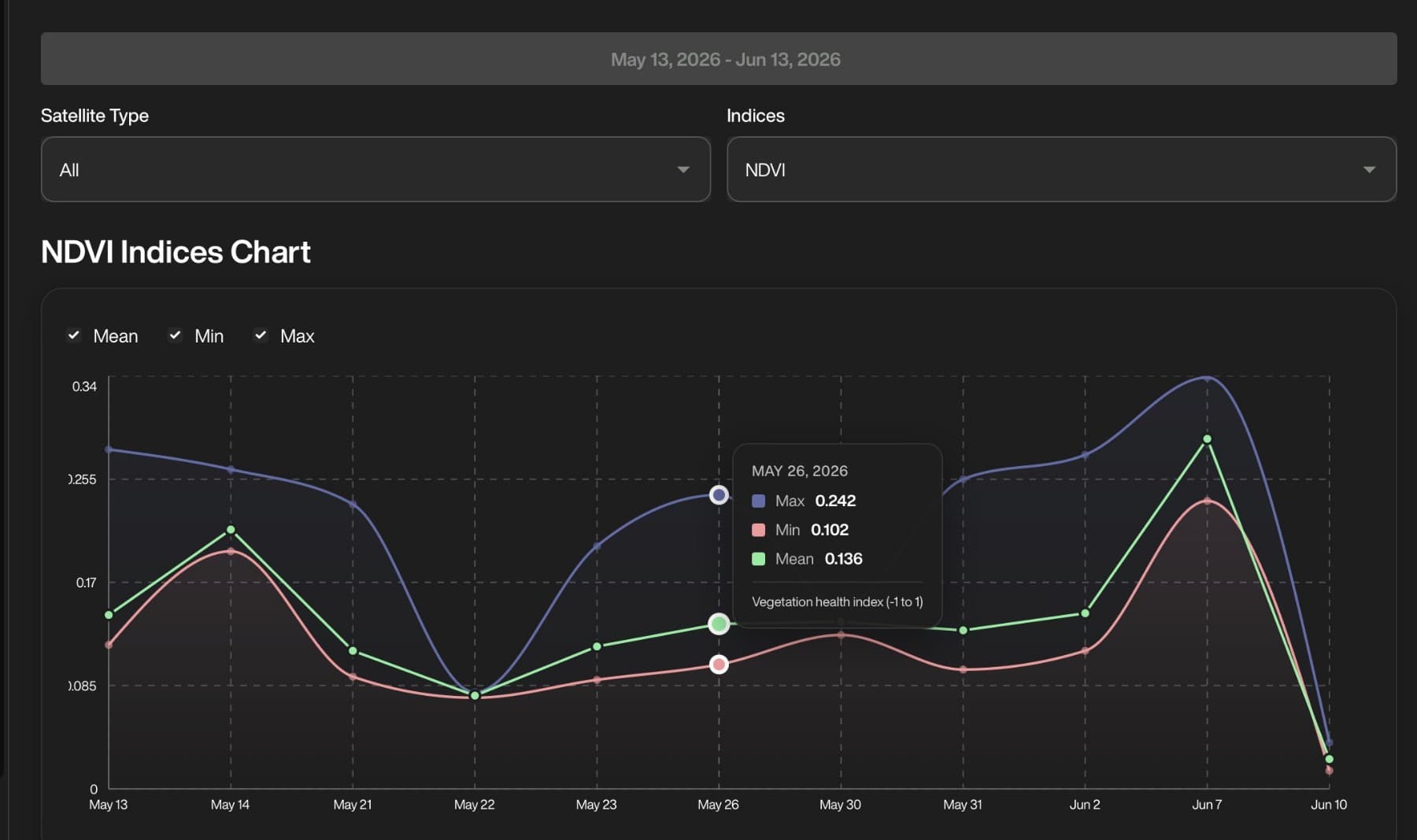
Visual Dashboards
Maps, alerts, and trends presented the way operators think — clear enough for a glance, deep enough for a plan.
See more, do less
Your whole operation monitored in near-real-time — without walking every row to know what's happening.
Make confident decisions
Weather, soil, and satellite signals fused into recommendations you can defend — to a bank, a board, or yourself.
Access made easy
Built for operators, not analysts. Clear visuals on any device — in the field, in the office, on the move.
10,000+ farmer profiles collected in the field — and counting.
/03How it works
01
Connect your fields
Draw your field boundaries or import them — minutes, not site visits.
02
We watch from orbit
Satellites, weather stations, and soil models stream into one living picture of your land.
03
Act on recommendations
Irrigation, fertilizer, and planting guidance ranked by impact — delivered before problems become losses.
/04Built for
SMALLHOLDER PROGRAMS
Scale extension services beyond the field visit
Give agricultural programs orbital eyes over thousands of smallholdings at once.
COMMERCIAL FARMS
Run every hectare on evidence
Optimize water, fertilizer, and pesticide application with per-field intelligence.
GOVERNMENT AGENCIES
National food-security situational awareness
Monitor production regions at state and national scale, season after season.
The AetherView family
AetherView Atrium — the same intelligence, indoors.
A living digital twin for greenhouses: climate, irrigation, and automation on one screen.
Your fields are already talking. Start listening.
AetherView is live — create an account and see your first field from orbit today.